Discover How Marine Navigation Equipment Improves Safety at Sea
Traveling at sea has always required careful planning and awareness. Unlike roads, there are no visible lanes or fixed paths on water, which makes direction and positioning more complex. This is where Marine Navigation becomes essential. It helps vessels determine their location, plan routes, and avoid potential hazards.
In earlier times, navigation relied heavily on stars, maps, and manual calculations. Today, modern equipment has transformed how ships and boats operate. Whether it’s a small fishing boat or a large cargo vessel, navigation tools provide guidance that improves safety and decision-making.
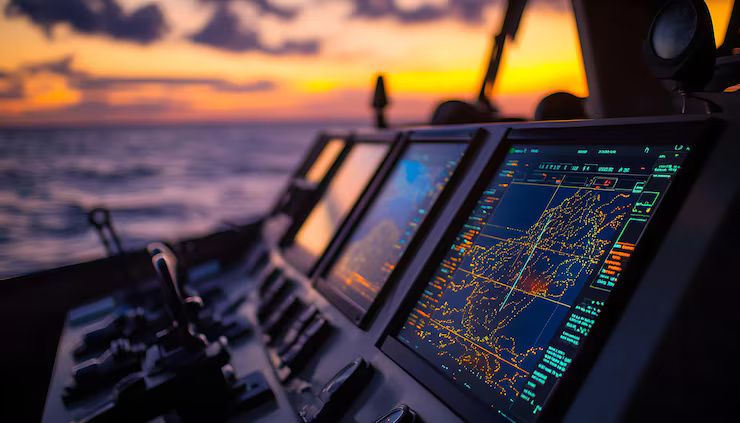
For anyone spending time on water, understanding how navigation equipment works is not just technical knowledge—it’s a practical necessity. It allows smoother journeys and helps avoid risky situations, especially during poor weather or low visibility.
Importance
Navigation at sea is directly linked to safety, efficiency, and confidence while operating a vessel.
Preventing Navigation Errors
Without proper guidance, it is easy to lose direction on open water.
- No fixed reference points: Unlike roads, the sea has no clear markings
- Changing conditions: Currents and winds can shift direction
- Limited visibility: Fog or darkness can reduce awareness
Using Marine Navigation tools helps maintain accurate positioning.
Avoiding Collisions and Hazards
Navigation equipment helps identify obstacles and nearby vessels.
- Traffic awareness: Tracks other vessels in the area
- Obstacle detection: Helps avoid reefs, rocks, or shallow areas
- Route planning: Keeps vessels on safe paths
These features are critical for safe movement in busy or unfamiliar waters.
Supporting Long-Distance Travel
For longer journeys, navigation becomes even more important.
- Route tracking: Ensures the vessel stays on course
- Fuel efficiency: Helps plan efficient paths
- Time management: Reduces delays caused by wrong directions
This is especially useful for commercial and transport vessels.
Recent Updates
Marine navigation technology has improved significantly in recent years.
GPS-Based Navigation Systems
Modern systems use satellite signals to provide accurate location data.
- Real-time positioning: Shows exact coordinates
- Route mapping: Helps plan and follow paths
- Integration with charts: Combines location with digital maps
Electronic Chart Display Systems
Digital charts have replaced many traditional paper maps.
- Interactive displays: Show routes and hazards clearly
- Automatic updates: Reflect changes in navigation data
- User-friendly interface: Easier to understand for operators
Radar and Sonar Technology
These tools improve awareness in difficult conditions.
- Radar systems: Detect nearby vessels and obstacles
- Sonar systems: Identify underwater features
- Enhanced safety: Useful during fog or night travel
Automated Navigation Assistance
Some vessels now include systems that assist with route tracking and steering, improving control and reducing manual workload.
Laws or Policies
Marine navigation is governed by international and local regulations to ensure safety.
Navigation Safety Rules
Operators must follow standard navigation guidelines.
- Maintain proper lookout: Always monitor surroundings
- Follow right-of-way rules: Avoid conflicts with other vessels
- Use navigation lights: Required during low visibility
Equipment Requirements
Certain vessels are required to carry specific navigation tools.
- Positioning systems: Ensure accurate location tracking
- Communication devices: Allow contact with other vessels
- Emergency signaling equipment: Supports safety in critical situations
Environmental Regulations
Navigation must consider environmental protection.
- Avoid restricted areas: Protect marine ecosystems
- Follow designated routes: Reduce environmental impact
Training and Certification
Operators are often required to understand Marine Navigation basics and safety procedures before handling vessels.
Tools and Resources
A variety of tools help improve navigation and safety at sea.
Common Marine Navigation Equipment
Several key tools are widely used.
- GPS devices: Provide location and direction
- Compass: Offers basic directional guidance
- Radar systems: Detect nearby objects
- Electronic charts: Display routes and hazards
These tools form the foundation of Marine Navigation.
Practical Navigation Techniques
- Plan routes in advance: Understand the journey before starting
- Monitor weather conditions: Adjust plans based on changes
- Check equipment regularly: Ensure everything is functioning
- Maintain awareness: Continuously observe surroundings
Backup Methods
Even with modern technology, traditional methods remain useful.
- Paper charts: Serve as backup references
- Manual compass use: Helps if electronic systems fail
- Basic navigation skills: Provide additional confidence
Learning Resources
- Navigation guides: Explain equipment and techniques
- Training courses: Help build practical understanding
- Simulation tools: Allow practice in controlled environments
FAQs
What is marine navigation?
Marine Navigation is the process of determining a vessel’s position and planning its route safely across water.
Why is marine navigation important for safety?
It helps avoid collisions, identify hazards, and maintain accurate direction, which are essential for safe travel at sea.
What equipment is used in marine navigation?
Common tools include GPS systems, compasses, radar, and electronic charts.
Can navigation be done without modern equipment?
Yes, traditional methods like compass navigation and chart reading can be used, but modern tools improve accuracy and ease.
How do navigation systems help in bad weather?
Navigation systems provide position data and detect nearby objects, helping maintain safety during low visibility conditions.
Conclusion
Marine navigation plays a vital role in ensuring safe and efficient travel at sea. With no fixed paths or clear boundaries, navigation tools provide the guidance needed to move confidently across water.
Modern equipment has made navigation more accurate and accessible, but understanding the basics remains important. By combining technology with awareness and preparation, operators can improve safety and maintain better control during their journeys.

Related Post...

How Leading Cosmetic Manufacturers Ensure Product Safety and Consistent Quality
Updated: April 17, 2026
Read More
Learn Industrial Water Recycle: Complete Guide to Sustainable Water Management
Updated: April 18, 2026
Read More